
Compulsory Areas
Home ![]() Compulsory Areas
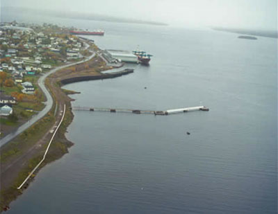
Compulsory Areas ![]() Bay of Exploits
Bay of Exploits
Bay of Exploits
| Compulsory Pilotage Area | Pilot Boarding Station | First ETA UTC (Hours) | Confirm or Correct ETA (Hours) | Departure / Movage Local Time (Hours) | Pilot Boat R/T Channel No. |
|---|---|---|---|---|---|
| (a) Botwood May 15 - Jan. 1 Depending on ice conditions Consists of all the navigable waters inside a line drawn from Govers Point at a position of Latitude 49° 19' 36.5" North, Longitude 55°13'42.2" West, to Cabbage Harbour Head at a position of Latitude 49°19'54"N, Longitude 55° 11' 42.5" West |
49° 19' 44"N 55° 12' 49"W |
12 | 4 | 4 | 16 |
| (b) Lewisporte May 15 - Jan. 1 Depending on ice conditions Consists of all the navigable waters inside a line drawn from Long Point at a position of Latitude 49° 21' 00" North, Longitude 54° 54' 18" West to Sivier Island, South End at a position of Latitude 49°20'30"N, Longitude 54° 58' 54" West |
49° 20' 45"N 54°56'31.5"W |
12 | 4 | 4 | 16 |
| (c) Botwood / Lewisporte Jan. 2 - May 14 Depending on ice conditions Off St. John's | 47° 33' 42"N 52° 37'54"W |
24 | 12 | 6 | 16 11 |