
Compulsory Areas
Home ![]() Compulsory Areas
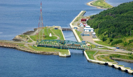
Compulsory Areas ![]() Strait of Canso
Strait of Canso
Strait of Canso
| Compulsory Pilotage Area | Pilot Boarding Station | First ETA UTC (Hours) | Confirm or Correct ETA (Hours) | Departure / Movage Local Time (Hours) | Pilot Boat R/T Channel No. |
|---|---|---|---|---|---|
| Zone C Consists of all the navigable waters within a line drawn from Red Head to Crichton Island Light and a line drawn from North Canso Light to Heffernan Pt. |
Northern Approach 45° 41' 42"N 61° 28' 18"W |
12 | 6 | 12 - Tentative 4 - Confirm |
14 |
| Chedabucto Bay For vessels not over 225.5 m (739.829 ft.) LOA |
Inner Approach 45° 29' 30"N 61° 11' 06"W |
12 | 6 | 12 - Tentative 4 - Confirm |
14 |
| Chedabucto Bay For vessels over 225.5 m (739.829 ft.) LOA |
Southern Approach 45° 24' 00"N 61° 01' 00"W |
12 | 6 | 12 - Tentative 4 - Confirm |
14 |
| St. Peter's Lock | Inner Approach 45° 32' 00"N 60° 46' 00"W |
12 | 6 | 12 - Tentative 4 - Confirm |
14 |
| Zone D Consists of all the navigable waters within a line drawn from Fox Island to Green Island in Chedabucto Bay and a line drawn from Red Head to Crichton Island Light. |
Southern Approach 45° 24' 00"N 61° 01' 00"W |
12 | 6 | 12 - Tentative 4 - Confirm |
14 |