
Compulsory Areas
Home ![]() Compulsory Areas
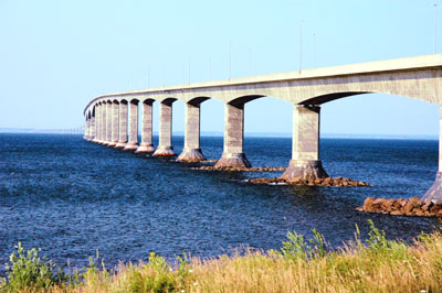
Compulsory Areas ![]() Confederation Bridge
Confederation Bridge
Confederation Bridge
| Compulsory Pilotage Area | Pilot Boarding Station | First ETA UTC (Hours) | Confirm or Correct ETA (Hours) | Departure / Movage Local Time (Hours) | Pilot Boat R/T Channel No. |
|---|---|---|---|---|---|
| Consists of all the navigable waters within a quadrilateral commencing at a point at Latitude 46° 11' 00" North, Longitude 63° 47' 00" West, on a bearing of 340° (True) for a distance of 4.4 nautical miles to a position at Latitude 46°15'12"N, Longitude 63° 49' 12" West, on a bearing of 107° (True) for a distance of 4.1 nautical miles to a position at Latitude 46°14'00"N, Longitude 63° 43' 30" West, on a bearing of 157° (True) for a distance of 3.75 nautical miles to a position at Latitude 46°10'30"N, Longitude 63° 41' 30" West, on a bearing of 277° (True) for a distance of 3.9 nautical miles to the point of commencement | N.W. Station 46° 15' 12"N 63° 49' 12"W |
24 | 6 | 6 | 16 |
| S.E. Station 46° 10' 30"N 63° 41' 30"W |
|||||
| Vessels transiting Confederation Bridge must indicate air draft. Ships sailing from PEI ports require 6 hours arrival notice. | |||||