
Compulsory Areas
Home ![]() Compulsory Areas
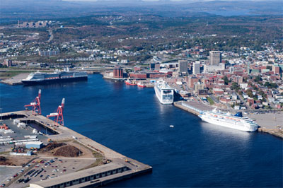
Compulsory Areas ![]() Saint John
Saint John
Saint John
| Compulsory Pilotage Area | Pilot Boarding Station | First ETA UTC (Hours) | Confirm or Correct ETA (Hours) | Departure / Movage Local Time (Hours) | Pilot Boat R/T Channel No. |
|---|---|---|---|---|---|
| The Saint John compulsory pilotage area consists of all the navigable waters within a line drawn across the Saint John Harbour from a position at Latitude 45°15'48" N., Longitude 66°04'48" W., 136° (True) to a position at Latitude 45°15'42" N., Longitude 66°04'36.8" W. and all the navigable waters within a line bearing 180° (True) from Cape Spencer for a distance of 1.6 nautical miles, thence 270° (True) for a distance of 4.16 nautical miles, thence 295° (True) for a distance of 5.3 nautical miles to shore | 45° 10' 48"N 66° 03' 42"W |
12 | 4 | 4 | 16 12 |
| For Tankers and Liquid Natural Gas Carriers, the Compulsory Pilotage Area is extended: The area above, plus all the navigable waters within a line drawn from a position at Latitude 45°10.7' N, Longitude 66°02.64' W, thence to a position at Latitude 45°08.8' N, Longitude 66°03.65' W, thence to a position at Latitude 45°09.5' N, Longitude 66°05.8' W, thence to a position at Latitude 45°11.38' N, Longitude 66°04.58' W. |
Inbound 45°09.5'N 66°05.8'W |
||||
| Outbound 45°10'48"N 66°03'42"W |